Geovizer
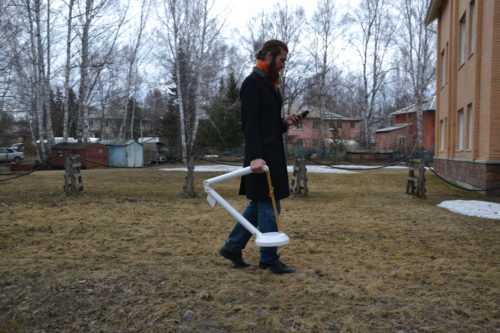
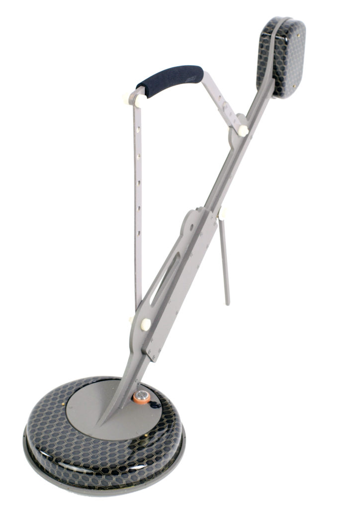
The multipurpose compact profiler “Geovizer” implements the method of induction multi-frequency sounding, and allows you quick and contactless measuring of the underground situation. As a result of research, it is possible to obtain the spatial distribution of the level of the secondary signal from the ground till 3 meters depth. The signal level allows for estimation of resistivity. High contrast targets such as – metal objects, cavities, watering with highly mineralized solution could be successfully localized in possible conditions. Also good targets – objects with high conductive (tunnels, bunkers with wet walls, pipes, etc.) thats lay in low conductive soil.
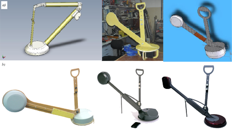
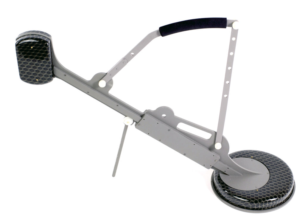
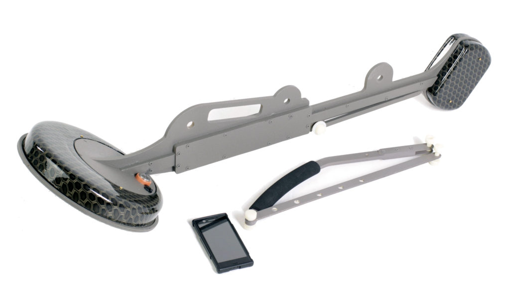
Three-frequency EM-I profiler “Geovizer” allows profiling on any set of 3 fixed frequencies in the 12.5 – 111 kHz range, including the automatic linking of the measuring point to global coordinates. The overall dimensions of the device (750 x 650 x 340 mm), weight (4.5 kg) and ease of management via a smartphone based on the Android operating system – all this greatly simplifies the process of data collection, and also increases the spatial resolution of the measuring.
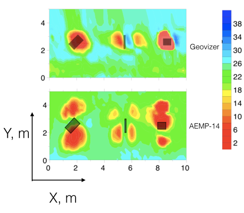
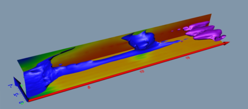
Preliminary results of measurements with “Geovizer” are visualized in real time on the smartphone display. Special software for smartphone allows you to build quasi-three-dimensional representations of the signal distribution.
Connection to the device is carried out according to the BlueTooth protocol.
Main features:
– Low weight and overall dimensions;
– Ability to perform air calibration;
– Advanced features of QZond / iiSystem software: calculation of App.Resistivity, signal phase.
Purposes that could be solved with the help of “Geovizer”:
Agronomy
Evaluation of the concentration of mineral fertilizers
Quality and effectiveness control of various procedures
Soil fertility assessment
Seasonal monitoring of changes in soil conditions
Investigation of soil condition, determination of fracture zones, watering
Utilities
Monitoring the state of the roadside space
Monitoring of underground communications
Search and localization of water leakage in underground pipelines
Determination of the location of underground utilities, structures, etc.
Engineering geology
geological engineering surveys
engineering and hydrological surveys
environmental engineering survey
Archeology
Localization of archaeological sites
Monitoring the condition of architectural monuments hidden under the ground
Detailed study of archaeological objects
Ecology
Agroecology
Analysis of the influence of man-made factors
Environmental supervision
Monitoring of potentially hazardous objects
Environmental risk management
Environmental assessment of soil contamination with fuels and lubricants
Detection and localization of industrial waste dumps of any chemical composition
Reclamation
Performance monitoring
Monitoring the dynamics of groundwater distribution
Security
Search for criminal caches, tunnels, tunnels
Detection of tie-ins into trunk pipelines
Search for the source of leakage and estimate the amount of leakage from trunk pipelines of petroleum products
|
General – Frequency range: 12,5-111 kHz (14 frqs); – Scan time for a single point: 0,3-0,9 с; – Transmitter power: 60 W; – Receiver sensitivity: 1 mV; – Dimensions: 90х75х25 cm – Battery operation time: 6 h; – Weight: 4,5 kg. – Software (Android, Windows). |
Instruction manual for “Geovizer” |
|
QZond 4.04 (Android) |
|
iiSystem 4.04 (Windows PC) |

QZond – designed for Android compatible devices (smartphones, tablets, smartphones, etc.) to collect data using “Geovizer” equipment, provides primary visualization of data in the form of maps, apparent depth cuts and signal distribution curves, has a simple and convenient interface, allows you to use embedded and external GNSS receivers, including RTK GNSS.
iiSystem – designed for visualization, as well as primary processing, preparation and export of data for subsequent analysis in other software (Surfer, Voxler, Paraview, etc.)
– engineering geology;
– building;
– agronomy;
– ecology;
– archeology;
– utilities;
– land reclamation;
– hydrogeology;
– special tasks.